TS2 – TIMARU SOUTH

00 final

I had heard about people fossicking on Timaru beaches, and Patiti Point had been mentioned. I couldn’t find any reference to Timaru in any of the few sources I had about fossicking in New Zealand. So in June 2020, when passing through Timaru, I set out to find the Patiti Point beach and take a look for myself. A short fossick turned up a few interesting stones but I felt they were few and far between and not always as smooth as I would have preferred (see Day 21 in this Post). Over the following year I saw some Posts of interesting Timaru area stones on the Facebook Group “New Zealand Lapidary, Rocks, Minerals, Fossils”, and someone mentioned Scarborough Road beach. I made my first visit to that area, a kilometre or so to the south of Patiti Point, on 5 June 2021, and found some stones that I really liked. Among the quartzites to be found here are some really nice green ones. Among the jaspers are some gorgeous hematites, and I have also found petrified wood. So far (up until February 2025), I have visited that Timaru South stretch of beach ten times. Note that beaches often change with each tide so some of the details of the beach and its stones in the description below may no longer be the same.

What I call Timaru South is a stretch of stony beach that starts near Redruth Park, just under one kilometre south of Patiti Point, and runs southwards a further four and a half kilometres or so, past the Jack’s Point lighthouse to the Ellis Road Beach carpark (see the two maps below left).

Along the northern part of this beach, from just south of Timaru to Mutu Mutu Point, the waves require significant alertness on the part of the fossicker as they break closer to shore than at the other beaches I tend to visit. There is little time between the sound of the breaking wave and its swift movement up the beach, because of the steep (if short) slope. Fossickers focus visually on stones, keeping an ear out for waves, and we often walk along the waves’ edge, making us vulnerable to wet legs from late breaking waves. Another safety issue relates to the cliffs along the back of much of the beach. These cliffs are steep, slippery and too high to climb should the high tide press a fossicker against them. It is best to avoid high tide for most of the southern three-quarters of the beach.

The most northern part of the Timaru South beach can be accessed from where Scarborough Road meets The Parade. Scarborough Road turns off State Highway One about one kilometre south of Timaru. The southern part of the beach is also accessible from the end of Ellis Road, a further kilometre or so south from the Scarborough Road turnoff. I usually park at the intersection of Scarborough Road and The Parade. On Google Maps, this is called “Jacks Point Surfspot” (see photo above, second from right). From here, you can walk across the railway onto the beginning of the Jack’s Point/Tuhawaiki Point Walkway. The walkway runs south atop the cliffs above the southern section of the beach, ending up at the Ellis Road Beach carpark, a 45 minutes walk. About 100 metres after crossing the railway, you can slip down onto the beach at the point where the track is closest to the beach and dips the lowest (see photos below).

Once on the beach, you can go either left (north) or right (south). To the left takes you towards Timaru, past the remains of an old wharf. A large bank of rocks has recently been constructed at the back of the beach, starting near the old wharf, to protect the likes of the railway line from coastal erosion. I have not yet fossicked much past the wharf.

At the beach entry, to the right takes you initially to what is marked on the topo map as Mutu Mutu Point, just under 300 metres away. Here you get waves coming from two directions and a small surf break. It is about 1,200 metres from Mutu Mutu Point to the lighthouse, and another 400 metres to the Ellis Road Beach carpark. There are usually lots of stones right along the beach from the entry point to Mutu Mutu Point.

North of Mutu Mutu Point, large patches of sand also appear across the beach and at times the stones can be scattered more thinly. The beach widens out as you move south and in a couple of places the cliffs disappear. I have twice encountered seals along this stretch. You can catch a glimpse of the lighthouse above you, and eventually you will reach the Ellis Road Beach carpark. The day I visited there in late June 2021 was foggy, as you can see in some of the photos below. I have fossicked a little south of the Ellis Road Beach carpark, and I found scatterings of stones to continue there. Note that the last part of Ellis Road to the carpark is gravel.

A YouTube video that has drone footage of the Timaru South beach from the Scarborough Road/Parade intersection to beyond the lighthouse is here.

Other TumbleStoneTwo Page on Timaru South Beach:

TIMARU SOUTH: MY STONE FOSSICKING

HOME – FOSSICKING BEACHES – BEACH STONES – TUMBLE-POLISHINGABOUT ME

TS2 – WARD BEACH: MY STONE FOSSICKING

rptx

I first drove out to Ward Beach in August 2020. Since then, I have visited it from time to time during my South Island fossicking trips, often during the journey back north. The following are Posts on TumbleStone Blog describing my visits to date, listed in chronological order:

Return to WARD BEACH

HOME – FOSSICKING BEACHES – BEACH STONES – TUMBLE-POLISHING

TS2 – WARD BEACH

00 final

Ward Beach is about six kilometres off the main road east from the small village of Ward in Marlborough. Ward is 82 kilometres north of Kaikoura and 45 kilometres south of Blenheim. I often stay at the Flaxbourne Motel in Ward on my fossicking trips to Southland as it is about an hour’s drive from the Picton ferry. However, it was not until August 2020 that I took the side trip to Ward Beach. In her book “The New Zealand Rockhound” (1981), Natalie Fernandez notes on page 113 that “flint, jasper, agate and fossil sponge” can be found here. I particularly look for stones of fine-grained limestone with zoophycos (trace fossils) which look quite soft so I haven’t tried to tumble polish them. In fact, I have not tumbled any Ward Beach stones to date, mainly because I have been focusing on stones from other beaches.

Ward Beach is set among spectacular scenery – high hills with steep slopes and a coastline with interesting rock formations. Driving from Ward to Ward Beach, there is a railway crossing with no bells/lights, a couple of one-way bridges, and a cattle-stop which you need to drive over very slowly.

The last two kilometres out to the beach is on gravel road through a small valley, with the Flaxbourne River alongside. The river reaches the coast just south of the carpark. The 368 metres high Weld Cone dominates the landscape to the south. The Ward Beach boulders (dolomite concretions that are 65 million years old) are 800 metres north of the carpark, maybe 10 minutes’ walk away. The beach was uplifted about two and a half metres by the 2016 Kaikoura earthquake, unveiling the boulders. See here for a good introduction to Ward Beach on the RV Explorer website, and here for a YouTube video of Ward Beach by a caravanner on holiday there. A YouTube video with drone footage of Ward Beach is here.

The main features of Ward Beach to the north of the Flaxbourne River are indicated on the map above (far left). Up behind the carpark is the Chancet Park overnight parking area, set up for members of the NZ Motor Caravanners Association, but also available to anyone with a self-contained van. A public toilet is also behind the carpark. The Flaxbourne River mouth is to the south of the carpark (see photos below) – I have fossicked up the river a way, there being stones on the riverbed and along the margins. North of the mouth is the main beach, in front of the carpark, another good place for fossicking. At low tide, the beach can be partly sandy, the stones mainly being higher up. The slope here can be steep, and powerful incoming waves can be dangerous.

Just north of here is a stretch dominated by rock platforms, though some small pockets of stones exist. The Ward Beach boulders are about halfway along this rocky part of the shore.

Beyond that, there is a sweeping stretch of beach that is sandy and stony, with the stones mainly at or above the high tide line (see photo above, lower row, second from left). A lot of the stones are quite small. After a small bay, some rocks run out from the shore, home to a fur seal colony. Just a few metres from here are the Chancet Rocks, a limestone outcrop. This area is a scientific reserve.

The Ward Beach page on Marlborough Online highlights the significance of the reserve: Following the 2016 Kaikōura earthquake, significant uplift of 2.2–2.6m occurred at Ward Beach exposing sedimentary rocks from the Cretaceous-Paleogene (K-T) boundary, approximately 66 million years ago, when a major mass extinction event occurred, ending the age of dinosaurs. The K-T boundary is a thin layer of dark grey clay in sedimentary rocks with a highly elevated level to normal of the rare element iridium, caused by a massive meteorite impact that left global fallout. The best place to observe the K-T boundary is about a kilometre north of Ward Beach at the Chancet Rocks reserve.

The beach to the south of the Flaxbourne River can be accessed only by fording the river. In summer, this is usually not a problem but it can be impossible after winter rainfall.

Initially, the pebbly beach just to the south of the river contains a lot of rocks on the seaward side, with pockets of stones sometimes lying in-between the rocks. Walking further, jagged outcrops of limestone thrust up through the sand and pebbles. Three kilometres along a long sweeping beach is Needles Point. The Needles are a spectacular coastal limestone outcrop, a bit like Chancet Rocks to the north.

Other TumbleStoneTwo Page on Ward Beach:

WARD BEACH: MY STONE FOSSICKING

HOME – ABOUT ME – FOSSICKING BEACHES – BEACH STONES – TUMBLE-POLISHING

TS2 – KAKANUI’S SEADOWN BEACH: THE STONES

rptx

There are some gorgeous stones for tumble-polishing to be found at Seadown Beach and on other beaches along this coast. Twenty kilometres south of Kakanui is Moeraki, famous for its boulders. The Moeraki area tends to have more prominence than Kakanui when beach stones are discussed. Furthermore, beach agates and chalcedony tend to receive the most attention of the range of stones along this coast. For example, Jocelyn Thornton has a page on “Moeraki-Kakanui” in her booklet “Gemstones” (also available online). Most of the stones she refers to are agates or chalcedony. The two exceptions are a “green and yellow-ochre jasper” and a “quartzite from Central Otago” (see the two photos below, top row, left).

I had been told before going to the Kakanui area that the beaches here were a good place to find beach agates. However, it was yellow quartzites that first caught my eye at Seadown Beach, and I soon found other quartzites there (see above). I recognised them because I had become familiar with them at Birdlings Flat. I also quickly started to stumble across some very nice dark red jaspers, especially brecciated ones (see above, lower line, second from left). Then someone on Facebook asked me if I had found any “limonite prase”. I eventually found out what these looked like – I think they are Thornton’s “green and yellow-ochre jasper”. I have since kept an eye out for them. I have found fewer agates than I expected. Over time, I discovered stones on Seadown Beach that were relatively soft and contained tiny fossils (see photo above, lower line, second from right). I eventually identified these as “hash fossil” stones, what I now call “fossilised seafloor” stones. I have also found on rare occasions pieces of petrified wood. Apart from these, a wide range of other interesting stones have been collected by me.

Posts on TumbleStone Blog featuring Seadown Beach stones:

Many of the stones I find on Seadown Beach are not identifiable by me, despite being well worth polishing. The following list contains the main types of stones I collect on Seadown Beach, in alphabetical order. The links are to Blog Posts featuring that stone type and which sometimes provide some information about it. In some of these Posts, the stone might appear simply as a specimen (and you might have to scroll through the Post to find it). Note that many more Blog Posts contain examples of most of these types.

Return to KAKANUI’S SEADOWN BEACH

KAKANUI’S SEADOWN BEACH: LOCATION ON NORTH OTAGO COASTLINE

KAKANUI’S SEADOWN BEACH: MY STONE FOSSICKING

HOME – FOSSICKING BEACHES – BEACH STONES – TUMBLE-POLISHING

TS2 – KAKANUI’S SEADOWN BEACH: MY STONE FOSSICKING

rptx

I first visited Kakanui’s Seadown Beach in June 2020. Since then, it has been a regular stop on my way south to the beaches of Southland, as well as on my return north. I tend to stay two or three days in the area, to allow me to put in a good number of fossicking hours. The following are Posts on TumbleStone Blog describing a selection of these visits, listed in chronological order:

Return to KAKANUI’S SEADOWN BEACH

HOME – FOSSICKING BEACHES – BEACH STONES – TUMBLE-POLISHING

TS2 – KAKANUI’S SEADOWN BEACH: LOCATION ON NORTH OTAGO COASTLINE

rptx

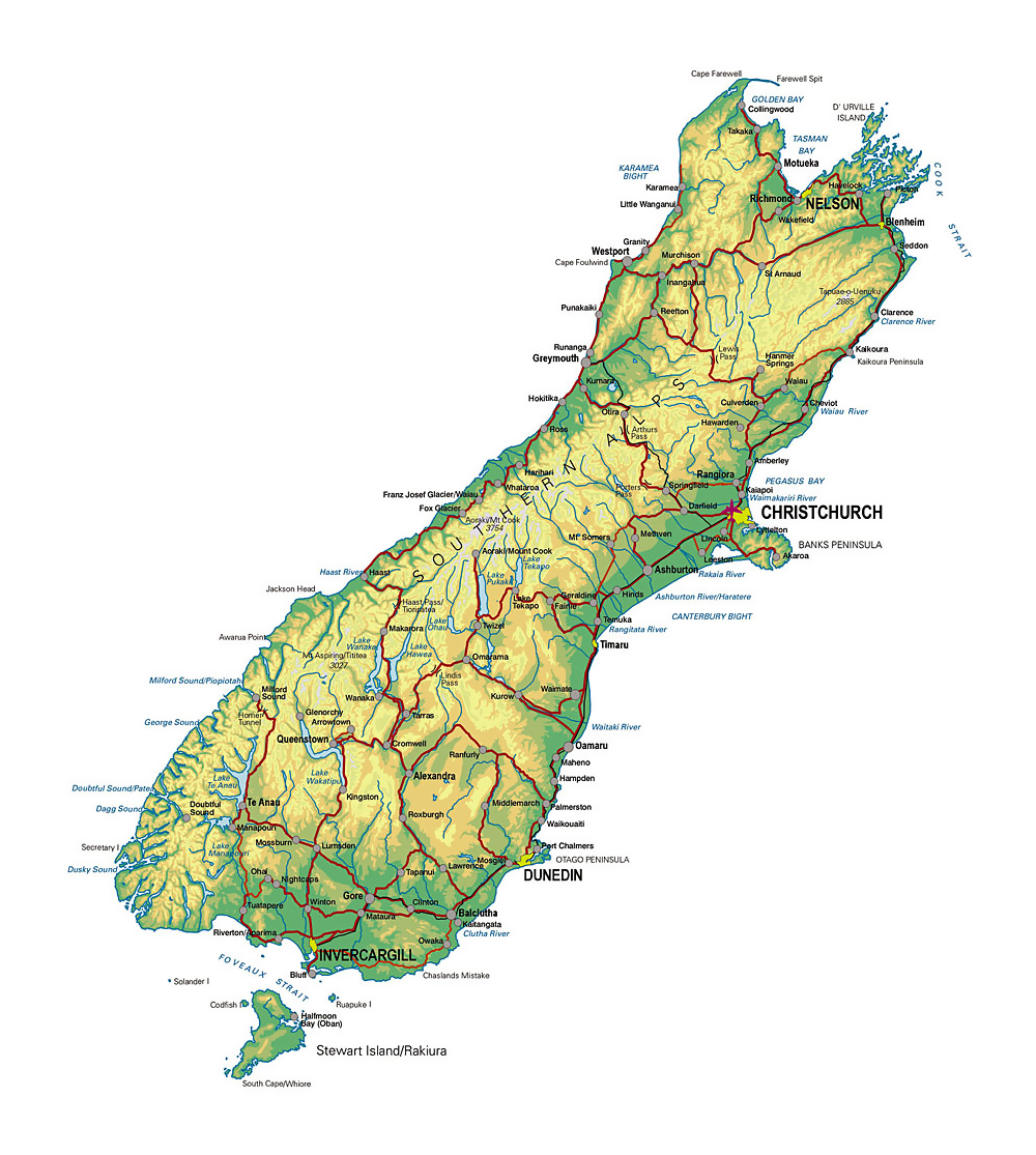
The beach that I call Seadown Beach lies on a 20 kilometres stretch of North Otago coast between the mouth of the Waianakarua River and the headland of Cape Wanbrow just south of the city of Oamaru (see the two maps above on the left). This coast has been subject to active erosion for a number of years (see photo above, second from right). “Between 1957 and 2002, the average rate of erosion along Beach Road was about 50 cm per year, and a 2002 consultancy report estimated that this part of the coast had been eroded by up to 29 metres over 28 years in some places” (see Section 5.3 of “Planning on a Retreating Coastline: Oamaru, North Otago, New Zealand”, a 2009 GNS Report). One of the implications of this is that at high tides, care needs to be taken by fossickers to avoid being caught between powerful waves and the cliff at the back of the beach.

I have visited a number of points along this coast, finding that Seadown Beach best suits my fossicking purposes. On page 116 in her book, “The New Zealand Rockhound” (1981), Natalie Fernandez lists three places in this area as good for fossicking: All Day Bay, Kakanui River, and Waianakarua River (see photo above, far right). The Waianakarua River mouth lies at the southern end of this stretch of coast (see photos below). I visited there in March 2022, as described towards the end of this Post. There are lots of stones at the river mouth although a little bit north is a large rock shelf and further on are long stretches of sandy beach. My brief fossick here revealed a range of stones – some jasper and porphyry interested me. But there were not the smooth jaspers and quartzites that can be found at Seadown Beach. I have not ventured up the Waianakarua River itself. (An interesting general introduction to the river can be found in the Otago Regional Council 2018 report “Waianakarua River Morphology and Riparian Management Strategy”. A 1993 article on fossils found in the river has been published in the “Journal of the Royal Society of New Zealand”.)

I have been told by local fossickers that beach agates can be found along this part of the coast, and I have found a couple on the three brief visits I have made here.

Between the Waianakarua River mouth and All Day Bay, a stretch of about five kilometres, the beach is a mix of stones and sand, often with the stones towards the back of the beach, near the low cliffs. Some stretches of primarily sandy beach are also here. A handful of parking areas on the side of the road can be found, though making one’s way down the cliff can be tricky. Recently I was told by a friend that a fossick along this stretch one day had resulted in a number of agates, but another fossick not long after had not been productive. Freedom camping is allowed at All Day Bay, at the Orore Point end, where public toilets are also located (see here for a camper’s account of the camping area). Because of fossils found in the area, it is part of the Vanished World trail. Fernandez stated in 1981 that “agate, chert and plasma” can be found at All Day Bay (see photo on far right at top of this Page). The Otago Rock and Mineral Club has photos of agates and prase (limonite prase) found at All Day Bay (see two photos below, second row, far right).

I stopped to have a fossick at All Day Bay in March 2022. I parked at the camping area and walked out onto a very sandy beach. I then moved southwards to the rocky cliff of Orore Point – there I found some small pockets of stones in the rocks, but nothing worth collecting. The Bay beach seems to stretch for about five kilometres, plenty of room for stones to be found.

Just north of All Day Bay is the Kakanui River mouth, located inbetween Kakanui’s South Head and North Head (see the two maps below, left). The river splits the village in two, with a one-way bridge across the river about a kilometre from the coastline. This YouTube video provides drone footage of the river mouth area, including what is referred to on Google Maps as “Kakanui Beach”.

Kakanui Beach runs from the river mouth northwards to Kakanui North Head, also known as Cats-Eye Point. This YouTube video starts at the Point and shows the whole beach plus the Kakanui River estuary. White-baiters can be seen at the river mouth. Cars are able to drive from the Kakanui village store along Cobblestone Road to the river mouth and park on the narrow strip between the estuary and the sea, part of the shingle bar. There are lots of stones here, many well-worn by the river. It is worth a fossick, though my preference remains with Seadown Beach, which has a greater variety and more of the kind of stones I am interested in.

During my visit, I saw a wooden pole sticking up out of the sea, just seawards of the river mouth (see photo below, left). It turns out that the Kakanui area was a bustling one in the 1860s and 1870s with, among other industries, a meat preserving company, the largest in New Zealand at the time, and flax works. In the late 1860s, steps were taken to build a port here, and a substantial wharf was built (see photo below, second from left). Between then and the early 1880s, much produce moved in and out, with up to 80 ships calling per year. But Oamaru port proved a strong competitor as did the railways. The meat works closed in the 1880s, and Kakanui port ceased to operate in 1886.

Before leaving this area, a note on the Kakanui mineral breccia that can be found just to the north. I have sometimes found stones of this breccia on the beach and it looks interesting but does not polish.

Cats-Eye Point, at the north end of Kakanui Beach, has a sign pointing towards it for “Kakanui Mineral Breccia”, but there is no information provided about it despite, it seems, being of much interest to geologists, in New Zealand and internationally.

A guide for a self-drive tour of East and Central Otago geology directs you to Cats-Eye Point at Kakanui as the key site for Kakanui mineral breccia (see photo above, second from left). “The Kakanui Mineral Breccia is a mineral-rich fragmental rock which formed from the contact of an intruding magma with water about 31.6 million years ago (Early Oligocene). The resulting violent eruption totally disrupted the magma components into angular fragments… The site of the explosive eruption is in the centre of the bay immediately south of this point” (page 11). The guide goes on to provide a technical description of the constituents of the breccia on page 12. In 2017, a presentation about electron probe microanalysis referred to the use of Kakanui mineral breccia to develop probe standards, noting a number of geological aspects of the breccia. The presentation included a map of the breccia’s distribution along the coast (see photo above, centre). The Kakanui School Centennial History included a short chapter “Geology of the Kakanui District” which gave prominence to the mineral breccia (see below).

North of Cats-Eye Point (Kakanui North Head), rocky cliffs dominate the coast for about three kilometres, until the start of Seadown Beach. A sweeping stretch of beach runs from there for about five kilometres up to Cape Wanbrow, with the Beach Road Reserve located about three kilometres along (see map, below left). After parking near the start of Seadown Beach, you have to negotiate a steep descent of about 10 metres down to the sand. Once there, to the right (south) is the end of the rocky cliffs that define the southern edge of Seadown Beach. At low tide, it often pays to fossick for up to 200 metres or so along the bottom of those cliffs as piles of stones can be swept up to lie there. But watch out for the incoming tide, as well as for the occasional seal!

Walking northwards from the start of Seadown Beach (see photos below), the cliffs at the back of the beach are only four or five metres high, occasionally with large boulders having been dumped along them to minimise erosion. The beach is subject to daily change, with stones lying on top of the sand at times, under the sand at others. Often the best time for fossicking along this stretch is from mid to high tide when the waves lap the stones lying on the upper half of the beach.

Kakanui Beach Road Reserve lies three kilometres from the southern end of Seadown Beach. I stopped there for a fossick in June 2020. At that time, the stones were much more scattered on the beach than at Seadown Beach, though I spotted some interesting jaspers.

I have not visited the beach north of the Kakanui Beach Road Reserve.

Return to KAKANUI’S SEADOWN BEACH

HOME – FOSSICKING BEACHES – BEACH STONES – TUMBLE-POLISHING

TS2 – SAPPHIRE

00 final

“Sapphire” was mentioned on the Heritage Trails sign that once stood in front of Gemstone Beach. It is a very rare and elusive stone and certainly not of “gem quality”. The following is a TumbleStone Blog Post on Gemstone Beach sapphire, written in June 2019: The “Elusive Sapphire” of Gemstone Beach

Return to BEACH STONES

Return to GEMSTONE BEACH: THE STONES

FOSSICKING BEACHES – BEACH STONES – TUMBLE-POLISHING

TS2 – GEMSTONE BEACH: THE STONES

rptx

A Heritage Trails sign once stood in front of Gemstone Beach but it is no longer there (see photo above, left). It noted that some of the “gems” to be found on this beach include “Hydrogrossular, Jasper, Garnet Sands, Rodingite, Epidote, Fossil Worm Casts, Idocrase, and Sapphire”. Of course, garnet sand is too small for tumble polishing, but the others sound promising. In her 1981 book, “The New Zealand Rockhound”, Natalie Fernandez lists Orepuki in her “Locations” chapter and states that the following can be found there: “Hydro-grossular garnet, orbicular jasper, garnet sands, rodingite, quartz dolerite pebbles, garnets, quartz, semi-nephrite, and fossil worm casts” (see photos below, left). Jocelyn Thornton has an entry on “Orepuki – Beach Pebbles” in her 1985 booklet “Gemstones” (also available online here). Her book is written for the beach stone fossicker and lapidarist (cutter and polisher of stones). She refers to grossular garnet, granite, gabbro, “altered volcanic rock with infilled bubbles”, rocks with worm trails and epidote, conglomerate, and orbicular jasper with metallic hematite (see photos below, right).

When I made my first couple of visits to Gemstone Beach, I had high hopes of finding something spectacular. That didn’t happen. Although I did manage to find fossil worm cast stones easily enough, and some nice stained quartz and dark red jasper. But it took me a number of visits, conversations and a bit of research to eventually be able to recognise hydrogrossular garnet stones. I have now also found a handful of orbicular (poppy) jaspers. Hours walking the beach, plus persistence, patience and research, have all paid off in the end. Over the past few years, I have found some very nice stones on Gemstone Beach, and it is my favourite fossicking site.

I once prepared an introduction to Gemstone Beach stones for a small retail outlet in Riverton that stocked a few I had polished. In that brief information pamphlet I wrote: These are tumble-polished naturally-occurring stones from Gemstone Beach. They were picked up while I walked along the beach, carefully observing wet stones (and dodging waves), selecting those with interesting colours and patterns. I then used a small rotary tumbler to smooth and polish them over a period of four weeks. The tumbler simulates the actions of the waves but intensifies it. In many instances, I do not know the exact type of rock from which the stones come. Each stone is unique but carries within it a significant part of New Zealand’s geological history. Each stone also tells its own story upon careful reading, and every person can see slightly different messages, landscapes, patterns and depths. These are the real gems of Gemstone Beach.

As time has gone on, I have been doing research on the different types of stones to be found on Gemstone Beach. A five-part Series of Posts that incorporates what I now (May 2025) understand about some of the stones starts with this one, “Thirty Gemstone Beach Pebbles for Doug: Part One – Stones 1 to 5”.

Many of the stones I have found on Gemstone Beach are not identifiable by me – I collect them and polish them because they are beautiful, intriguing and/or interesting. But I also find quite a number of stones that I think I can identify. The main types are listed below, in alphabetical order. Click on a stone for more information about it [Note: Links with * after them, e.g., Argillite*, have not yet been constructed. Some stone types for which a page has not yet been developed below may include links to TumbleStoneBlog Posts referring to such a stone.]

Amygdaloidal Stones (Volcanic with infilled bubbles)* Blog1 Blog2
Argillite* Blog1 Banded Argillite1 Banded Argillite2 Banded Argillite3 [Gn8 to Gn14] Spotted Argillite [Gn20 to Gn33]
Banded Ignimbrite* Blog1 Blog2
Breccia* Blog1 Blog2 Blog3
Conglomerate*
Blog
Fossil Coral*
Blog
Fossil Worm Casts (Trace Fossils)*
Blog1 Blog2
Granite* Blog1 [W77 to W80]
Hydrogrossular Garnet
Igneous (Black & White)*
Blog [W43 to W63]
Jasper*
Blog Brecciated Jasper Hematite Jasper Orbicular Jasper Poppy Jasper
Porphyry* Blog [Stone #2]
Quartz*
Blog1 Blog2
Quartzite*
Blog [Stone #9] Blog2 [Stone #25] Blog3
Rhodonite*
Blog1
Rhyolite*
Blog1
Sapphire
Thulite*
Blog1 Blog2 Blog3
Unakite*
Blog [2nd stone]

Return to GEMSTONE BEACH

HOME – FOSSICKING BEACHES – BEACH STONES – TUMBLE-POLISHING

TS2 – KAKANUI’S SEADOWN BEACH

rptx

South of the city of Oamaru in North Otago, the coast stretches for about 20 kilometres down past Kakanui to the mouth of the Waianakarua River. The beaches along here are often stony, though the amount of stones and the degree of their smoothness vary considerably. Fossickers have been known to visit a number of these beaches, including the Waianakarua River mouth and Kakanui Beach at the Kakanui River mouth. It was in June 2020 that I first explored this coastline and stumbled across a beach, two kilometres north of the village of Kakanui. I found a number of gorgeous quartzites and jaspers there, and it quickly became one of my favourite fossicking sites. Since then, I have also found petrified wood, limestone pebbles with tiny fossils in them, bryozoan fossils stones, and a piece of agatised bone.

The southern end of this beach is at the intersection of Thousand Acres Road/Beach Road and Seadown Road (a stretch of Beach Road to the north of here has been closed due to encroachment from the sea). I call it Seadown Beach. To the south is a stretch of rocky cliffs, to the north is a sweeping sandy beach with lots of stones (usually).

In February 2024, when I visited, I found that the sea had washed a lot of sand up over many of the stones. There were only isolated patches of pebbles here and there, though they were well worth searching.

This stretch of coast runs north for about five kilometres to the start of Cape Wanbrow, the headland just south of Oamaru. It is three kilometres from the start of Seadown Beach to the Beach Road Reserve. I mainly fossick along the initial 900 metres of Seadown Beach – at this stage, you come across a small number of boulders embedded in the sand.

Posts on TumbleStone Blog which provide an Introduction to Kakanui’s Seadown Beach:

Other TumbleStoneTwo Pages on Kakanui’s Seadown Beach:

KAKANUI’S SEADOWN BEACH: LOCATION ON NORTH OTAGO COASTLINE

KAKANUI’S SEADOWN BEACH: MY STONE FOSSICKING

KAKANUI’S SEADOWN BEACH: THE STONES

HOME – FOSSICKING BEACHES – BEACH STONES – TUMBLE-POLISHINGABOUT ME

TS2 – LIST OF CONTENTS TO DATE

00 final

Below are listed the pages of the TumbleStoneTwo website, with the date they were posted. They are listed in reverse chronological order, with the newest first, so that those people interested can check the most recent additions. Editing of and additions to pages will also be listed, unless they are very minor. Words in square brackets before a page refer to the main section of the website where the page is located.

TUMBLE-POLISHING – Up-dated and some minor additions, 9 May 2025

[FOSSICKING BEACHES] SLOPE POINT: THE STONES 9 May 2025

[FOSSICKING BEACHES] SLOPE POINT: MY STONE FOSSICKING 4 May 2025

[FOSSICKING BEACHES] SLOPE POINT 3 May 2025

[FOSSICKING BEACHES] KAKANUI’S SEADOWN BEACH: THE STONES – Up-dated and added links, 20 April 2025

BEACH STONES – I added a number of stone types and characteristics, including Amygdaloidal Stones, Argillite, Breccia, Bryozoan Fossils, Greywacke, and Quartz, 19 April 2025

[FOSSICKING BEACHES] WARD BEACH: MY STONE FOSSICKING – brought up-to-date, 19 April 2025

[FOSSICKING BEACHES] TIMARU SOUTH: MY STONE FOSSICKING – brought up-to-date, 19 April 2025

[FOSSICKING BEACHES] KAKANUI’S SEADOWN BEACH: MY STONE FOSSICKING – brought up-to-date, 18 April 2025

[FOSSICKING BEACHES] GEMSTONE BEACH: MY STONE FOSSICKING – brought up-to-date, 18 April 2025

[FOSSICKING BEACHES] WARD BEACHadded some information about the drive between Ward and Ward Beach, 12 September 2024

[FOSSICKING BEACHES] GEMSTONE BEACH AND ITS STONES: AN INTRODUCTION FOR THE PASSING MOTORIST – PART ONE, LOCATION AND CARPARK – added a warning for drivers about an especially bumpy road on State Highway 99 about 12 to 16 kms east of Gemstone Beach, 28 February 2024

ABOUT ME (THE SHORT VERSION) 8 February 2024

[FOSSICKING BEACHES] GEMSTONE BEACH AND ITS STONES: AN INTRODUCTION FOR THE PASSING MOTORIST – PART SEVEN-A, GREEN ARGILLITE STONES – added sections on green-causing minerals and on three-dimensional trace fossils, 18 December 2023

[FOSSICKING BEACHES] GEMSTONE BEACH AND ITS STONES: AN INTRODUCTION FOR THE PASSING MOTORIST – PART SEVEN-A, GREEN ARGILLITE STONES 16 December 2023

[FOSSICKING BEACHES] GEMSTONE BEACH AND ITS STONES: AN INTRODUCTION FOR THE PASSING MOTORIST – PART SIX-D, STONES WITH OPAQUE WHITE “PATCHES” 4 October 2023

[FOSSICKING BEACHES] GEMSTONE BEACH AND ITS STONES: AN INTRODUCTION FOR THE PASSING MOTORIST – PART SIX-C, STONES WITH OPAQUE WHITE VEINS & BANDS 3 October 2023

[FOSSICKING BEACHES] GEMSTONE BEACH AND ITS STONES: AN INTRODUCTION FOR THE PASSING MOTORIST – PART SIX-B, STONES WITH WHITE SPOTS & CRYSTALS 15 September 2023

[FOSSICKING BEACHES] GEMSTONE BEACH AND ITS STONES: AN INTRODUCTION FOR THE PASSING MOTORIST – PART SIX-A, WHITE STONES 30 August 2023

[FOSSICKING BEACHES] GEMSTONE BEACH AND ITS STONES: AN INTRODUCTION FOR THE PASSING MOTORIST – PART FIVE, TRANSLUCENT STONES 22 August 2023

[FOSSICKING BEACHES] GEMSTONE BEACH AND ITS STONES: AN INTRODUCTION FOR THE PASSING MOTORIST – PART FOUR, BRIEF INTRODUCTION TO GEOLOGICAL TERMS FOR STONES 19 August 2023

[FOSSICKING BEACHES] GEMSTONE BEACH AND ITS STONES: AN INTRODUCTION FOR THE PASSING MOTORIST – PART THREE, SOURCES OF INFORMATION & WHAT IS A GEMSTONE 13 August 2023

HALL OF FAME – #4 added, trace fossil in argillite from Gemstone Beach, 8 August 2023

[FOSSICKING BEACHES] GEMSTONE BEACH AND ITS STONES: AN INTRODUCTION FOR THE PASSING MOTORIST – PART TWO, MAIN FEATURES OF THE BEACH 28 July 2023

[FOSSICKING BEACHES] GEMSTONE BEACH AND ITS STONES: AN INTRODUCTION FOR THE PASSING MOTORIST – PART ONE, LOCATION AND CARPARK 25 July 2023

HALL OF FAME – #3 added, hematite jasper from Timaru South, 25 May 2023

[FOSSICKING BEACHES] WARD BEACH – I added some information about the area to the south of the Flaxbourne River, 2 April 2023

[FOSSICKING BEACHES] KAKANUI’S SEADOWN BEACH: THE STONES I added links to relevant informative TumbleStoneBlog Posts for some of the stones, 2 April 2023

HALL OF FAME 24 February 2023

[FOSSICKING BEACHES] GEMSTONE BEACH: THE STONES I provided links to relevant informative TumbleStoneBlog Posts for some of the stones, 19 February 2023

BEACH STONES For three stone types – jasper, rhyolite and trace fossils – I provided links to relevant informative TumbleStoneBlog Posts, 6 February 2023

FOSSICKING BEACHES For beaches which have not yet had a page constructed about them, I provided links to relevant informative TumbleStoneBlog Posts, 4 February 2023

[FOSSICKING BEACHES] MY THOUGHTS ON SAFETY ON THE BEACH, AND FOSSICKING ETIQUETTE Added a short paragraph related to a recent controversial case of fossil removal in New Zealand, 8 November 2022

[FOSSICKING BEACHES] MY THOUGHTS ON SAFETY ON THE BEACH, AND FOSSICKING ETIQUETTE 19 June 2022

[FOSSICKING BEACHES] TIMARU SOUTH: MY STONE FOSSICKING 19 June 2022

[FOSSICKING BEACHES] TIMARU SOUTH 19 June 2022

[FOSSICKING BEACHES] WARD BEACH: MY STONE FOSSICKING 14 June 2022

[FOSSICKING BEACHES] WARD BEACH 13 June 2022

[FOSSICKING BEACHES] KAKANUI’S SEADOWN BEACH: THE STONES 11 June 2022

[FOSSICKING BEACHES] KAKANUI’S SEADOWN BEACH: MY STONE FOSSICKING 10 June 2022

[FOSSICKING BEACHES] KAKANUI’S SEADOWN BEACH: LOCATION ON NORTH OTAGO COASTLINE 10 June 2022

[BEACH STONES] SAPPHIRE 7 June 2022

[FOSSICKING BEACHES] GEMSTONE BEACH: THE STONES 5 June 2022

[FOSSICKING BEACHES] KAKANUI’S SEADOWN BEACH 5 June 2022

[BEACH STONES] HYDROGROSSULAR GARNET: PHOTOS, PART TWO 2 June 2022

[BEACH STONES] HYDROGROSSULAR GARNET: PHOTOS, PART ONE 2 June 2022

[FOSSICKING BEACHES] GEMSTONE BEACH: LOCATION ON TE WAEWAE BAY 2 June 2022

[FOSSICKING BEACHES] GEMSTONE BEACH: MY STONE FOSSICKING 2 June 2022

[FOSSICKING BEACHES] BIRDLINGS FLAT: MY STONE FOSSICKING 2 June 2022

[FOSSICKING BEACHES] BIRDLINGS FLAT: GEMSTONE & FOSSIL MUSEUM 2 June 2022

[BEACH STONES] HYDROGROSSULAR GARNET 2 June 2022

[FOSSICKING BEACHES] BIRDLINGS FLAT 2 June 2022

[FOSSICKING BEACHES] GEMSTONE BEACH 2 June 2022

BEACH STONES 2 June 2022

TUMBLE-POLISHING 2 June 2022

FOSSICKING BEACHES 2 June 2022

TUMBLESTONETWO WEBSITE – HOME PAGE 2 June 2022

HOME FOSSICKING BEACHESBEACH STONESTUMBLE-POLISHING